Heavy rains likely to lash parts of Gujarat over the week; Orange alert during Sept 3-6
September 01, 2025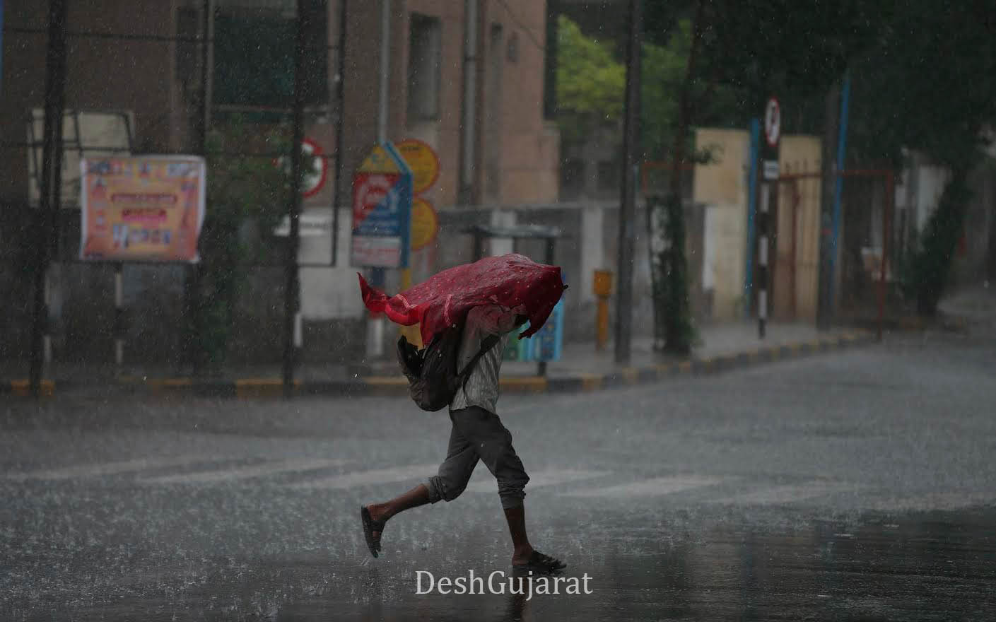
Surat: The Indian Meteorological Department (IMD), in its latest forecast, has predicted that heavy rainfall is likely to occur in many places of Gujarat during the next week till September 7th, while on September 4th and 5th, a few places might get extremely heavy rains.
As per the IMD bulletin, heavy rains are very likely at isolated places in Sabarkantha, Aravalli, Panchmahal, Dahod, Mahisagar, Chhota Udepur, Navsari, Valsad, and in Daman, Dadra, and Nagar Haveli, on September 1st.
On September 2nd, heavy rains are very likely at Navsari, Valsad, and in Daman, Dadra, and Nagar Haveli.
On September 3rd, heavy to very heavy rains are very likely in Narmada with orange alert in place, while Dahod, Chhota Udepur, Dang, Navsari, Valsad, Tapi, and in Daman, Dadra, and Nagar Haveli are on yellow warning.
On September 4th, heavy to very heavy rains at isolated places, with isolated extremely heavy falls, are very likely in Narmada, Tapi, Chhota Udepur, and Dang, and these places are on orange alert.
While yellow warning of heavy rains is issued for Aravalli, Kheda, Anand, Panchmahal, Dahod, Mahisagar, Vadodara, Bharuch, Surat, Navsari, Valsad, and in Daman, Dadra, and Nagar Haveli; in the districts of Saurashtra-Kutch, namely Amreli, Bhavnagar, Gir Somnath, and in Diu.
On September 5th, heavy to very heavy rains at isolated places, with isolated extremely heavy falls, are very likely in the districts of Gujarat region namely Surat, Navsari, Valsad, and in Daman, Dadra, and Nagar Haveli, Narmada, Bharuch, Dang, and Tapi; in the districts of Saurashtra-Kutch namely Amreli, Bhavnagar, and Botad, and orange alert has been issued in these places.
While heavy rains are very likely at isolated places in the districts of Gujarat region namely Banaskantha, Patan, Mehsana, Sabarkantha, Gandhinagar, Aravalli, Kheda, Ahmedabad, Anand, Panchmahal, Dahod, Mahisagar, Vadodara, and Chhota Udepur; in the districts of Saurashtra-Kutch namely Rajkot, Junagadh, Gir Somnath, and in Diu.
On September 6th, the orange alert is issued for Bharuch, Surat, Navsari, Valsad, and in Daman, Dadra, and Nagar Haveli, Bhavnagar, and Botad. Additionally, heavy rains are very likely at isolated places in the districts of Gujarat region namely Banaskantha, Patan, Mehsana, Sabarkantha, Gandhinagar, Aravalli, Kheda, Ahmedabad, Anand, Panchmahal, Dahod, Mahisagar, Vadodara, Chhota Udepur, Narmada, Dang, and Tapi; in the districts of Saurashtra-Kutch namely Surendranagar, Rajkot, Junagadh, Amreli, Gir Somnath, and in Diu.
On September 7th, heavy rains are very likely at isolated places in the districts of Gujarat region namely Banaskantha, Patan, Mehsana, Sabarkantha, Aravalli, Ahmedabad, Anand, Vadodara, Narmada, Bharuch, Surat, Dang, Navsari, Valsad, Tapi, and in Daman, Dadra, and Nagar Haveli; in the districts of Saurashtra-Kutch namely Surendranagar, Rajkot, Jamnagar, Porbandar, Junagadh, Amreli, Bhavnagar, Morbi, Dwarka, Gir Somnath, Botad, Kutch, and in Diu.
Synoptic Situation:
-
The monsoon trough at mean sea level passes through Ganganagar, Pilani, Datia, Satna, Daltonganj, Digha, and then east-southeastwards to the northeast Bay of Bengal.
-
The upper air cyclonic circulation over Myanmar coasts and adjoining northeast Bay of Bengal lies over northeast Bay of Bengal and adjoining Myanmar coast, extending up to 5.8 km above mean sea level and tilting southwestwards with height. Under its influence, a low-pressure area is likely to form over the north Bay of Bengal in the next 24 hours.
-
A trough runs from the above cyclonic circulation over northwest Rajasthan and surrounding areas to Jharkhand across north Madhya Pradesh and south Uttar Pradesh, extending up to 3.1 km above mean sea level.
-
Yesterday’s upper air cyclonic circulation over northwest Madhya Pradesh at 0.9 km above mean sea level has merged with the above trough.
-
Yesterday’s upper air cyclonic circulation over northeast Rajasthan now lies over northwest Rajasthan and surrounding areas, extending up to 5.8 km above mean sea level.
Recent Stories
- Residents Allege Disturbed Areas Act Violation in OP Road Societies in Vadodara; Submit Memorandum to Collector
- Why Some Petrol Pumps Ran Dry on Monday in Gujarat, Triggering Panic Among Consumers
- Land Acquisition Speeds Up for Four-Laning of Ankleshwar-Burhanpur Highway
- Rush for LPG to PNG switch: AMC issues hundreds of new permits for pipeline laying
- Reports on Closure of Few Petrol Pumps Unconfirmed and will be Verified: Officials