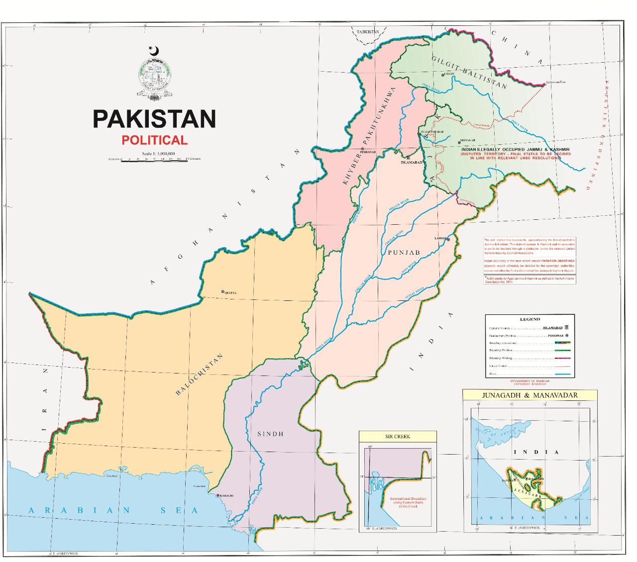
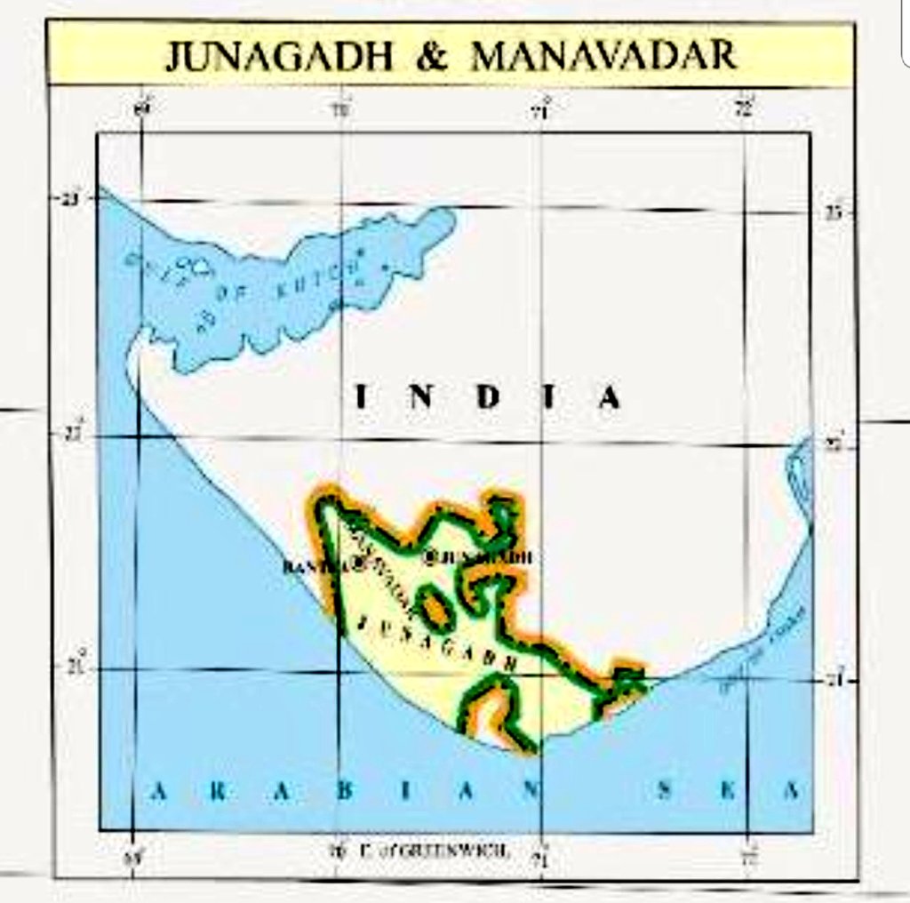
Pakistan unveils new political map of country; shows Junagadh, Manavdar and Sir Creek areas of Gujarat as Pakistani territory
August 04, 2020
Ahmedabad: Pakistan Prime Minister Imran Khan today unveiled a new “political map of Pakistan”, integrating Jammu and Kashmir (barring the portion on China side), Junagadh, Mavadar and Sir Creek in the country’s map. Imran while launching a new “political map” said it is backed by all political parties of the country. New map will be used in schools, colleges, domestically and internationally by Pakistan, Imran Khan said. While showing Jammu & Kashmir and Ladakh in Pakistan’s map is nothing new for Pakistan as it has been done in the past too, more laughable about a map released today is that Pakistan is showing erstwhile princely state of Junagadh and Manavdar (in Gujarat, India) as Pakistani territory. Pakistan has also shown disputed coastal territory Sir Creek in its map as Pakistani territory.

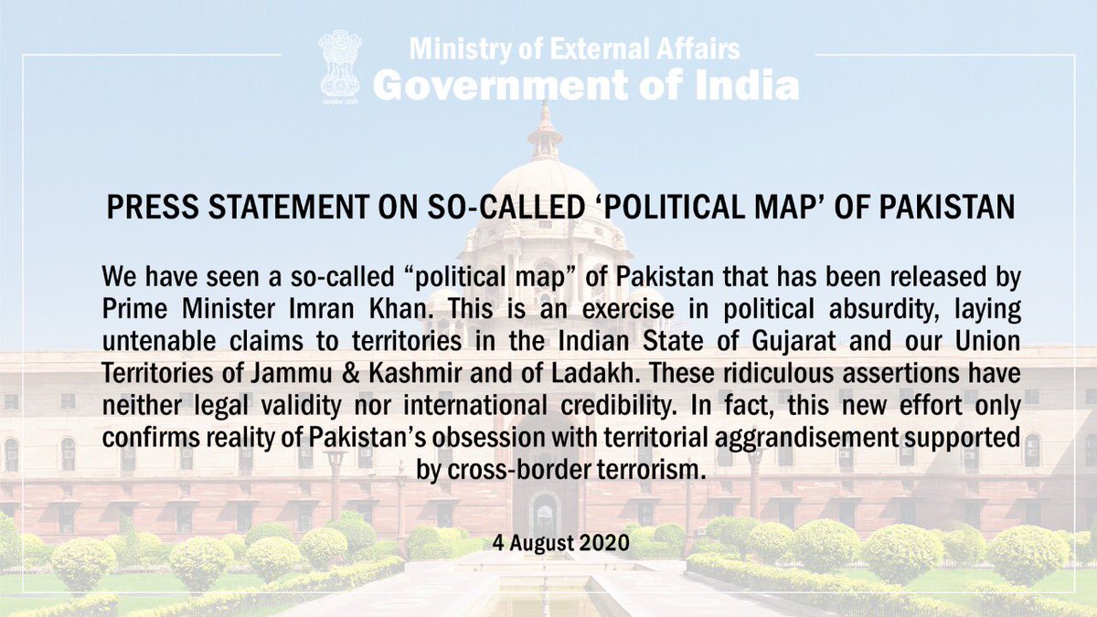
Ministry of External Affairs, Government of India’s statement on so-called ‘political map’ of Pakistan
DeshGujarat
Related Stories
Former Nawab family still dreaming that Junagadh is part of Pakistan
NSA Ajit Doval walks out of SCO meet after Pakistan projects a fictitious map claiming Kashmir and Junagadh as its territories
Recent Stories
- Rahul Gandhi to be on Gujarat visit on April 15–16
- Bridge City Surat likely to get one more bridge on April 18th
- Former MLA Mahesh Vasava quits BJP
- Work begins on 1.3-km tunnel in Poshina for Taranga Hill–Ambaji–Abu Road rail project
- AUDA to repair 3 bridges on SP Ring Road
- Gabbar Hill darshan, Parikrama route, Ropeway to remain shut from April 15-17
- Western Railway to run Udhna–Danapur Unreserved Special Train


