Gujarat HC Clears Way for Demolition of Asaram Ashram; Dismisses Plea
April 17, 2026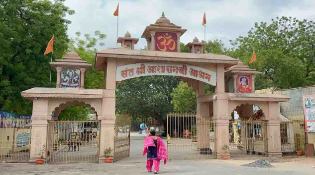
Ahmedabad: The legal battle over the Asaram Ashram on the banks of the Sabarmati River appears to have reached its final stage, with the Gujarat High Court dismissing the Ashram’s appeal and clearing the way for its demolition.
A Division Bench of the High Court upheld an earlier order passed by a Single Judge, which had validated the District Collector’s decision to reclaim the land. The court made strong observations, noting that the Ashram had violated government-imposed conditions and illegally encroached upon Sabarmati riverfront land.
Massive Land Dispute
The case revolves around more than 45,000 square metres of high-value land located near the Narendra Modi Stadium in Motera. Official records indicate that the Ashram was originally allotted approximately 33,980 square metres for limited religious use. However, government inspections found that its actual possession had expanded to nearly 50,000 square metres.
The land, estimated to be worth ₹500 crore, is now set to be reclaimed as part of a major development project linked to the upcoming Commonwealth Games.
The court also made it clear that regularisation of riverfront land would not be permitted under any circumstances.
During the hearing, the Ashram sought a four-week stay on the demolition to approach the Supreme Court. However, the Bench stated that such relief would be considered only if the Ashram filed an affidavit undertaking to vacate the land. The state government’s counsel informed the court that a fresh notice would be issued under Section 202 of the Gujarat Land Revenue Code before taking possession.
The Ashram, situated along the Sabarmati River, has existed for decades. The dispute began after the District Collector ruled that the Ashram had breached the terms and conditions of its land allotment, triggering prolonged litigation.
Scientific Evidence and Legal Findings
During the proceedings, the state government presented evidence based on GPS-enabled satellite mapping. This approach provided a precise, tamper-proof timeline of how the encroachment expanded over the years, minimising the scope for human error in measurement. DeshGujarat
Leave a Reply
Related Stories
Asaram Ashram Land Row: Gujarat HC Stays Coercive Steps, Reserves Judgment
HC clears takeover of Asaram Ashram land in Ahmedabad; over 30 illegal structures to be razed
AMC junks impact fee plea to regularise illegal encroachment by Asaram Ashram
Gujarat Govt issues eviction notices to ashrams for Olympic infrastructure in Motera
Recent Stories
- Parts of Gujarat may see Unseasonal Rain from April 19: IMD Forecast
- Delhi-Mumbai Expressway: Godhra - Vadodara Section Cuts Travel Time to 45 Minutes, Say Commuters
- Gujarat Police Detain 5 Habitual Narco-Offenders Under PIT NDPS Act; 21 Held in 2026 So Far
- Gujarat ACB nabs middleman in bribe trap; Cop, Home Guard declared wanted
- GT vs KKR: Gujarat Titans to Clash with Kolkata Knight Riders at Narendra Modi Stadium, Ahmedabad